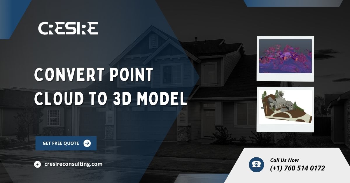
Convert Point Cloud to 3D Model for Your Project
Introduction to Point Clouds
Point clouds, in essence, represent the visual world in a digital format. They are comprised of countless points in a three-dimensional space, each point capturing specific spatial coordinates along with additional attributes such as color or intensity.
Point clouds are typically generated using specialized equipment like LiDAR sensors or through photogrammetry techniques. They serve as a rich source of spatial information, finding applications across various domains including surveying, urban planning, environmental monitoring, and cultural heritage preservation.
As technology advances, the generation and utilization of point clouds continue to evolve. This evolution opens up new possibilities for data analysis and visualization.
Understanding 3D Models
In contrast to point clouds, which are essentially a collection of data points, 3D models provide a structured representation of objects in three-dimensional space. These models are constructed using vertices, edges, and faces to create solid shapes, allowing for realistic rendering and manipulation.
Unlike static images or two-dimensional drawings, 3D models offer a comprehensive view of an object from multiple angles, enabling detailed analysis and visualization.
They find widespread applications in various industries such as architecture, manufacturing, animation, and medical imaging, facilitating tasks ranging from design prototyping to virtual simulations.
Challenges to Convert Point Cloud to 3D Model
Convert Point Cloud to 3D Model presents several challenges. One of the primary issues is the inherent noise and variability present in point cloud data, stemming from factors such as sensor limitations, environmental conditions, and object complexity.
The noise can result in inaccuracies and inconsistencies in the final model, requiring careful processing and filtering. Additionally, the sheer volume of data contained within point clouds can pose challenges in terms of computational resources and processing time.
Moreover, ensuring the alignment and registration of multiple-point cloud scans adds another layer of complexity to the conversion process.
Addressing these challenges requires a combination of advanced algorithms, computational techniques, and domain expertise to produce a high-quality Point Cloud to 3D Model.
Tools and Software for Point Cloud Conversion
Free Tools
- MeshLab: MeshLab is an open-source software package for processing and editing 3D triangular meshes. It offers a wide range of tools for cleaning, repairing, and refining mesh data, making it suitable for point cloud conversion tasks.
- CloudCompare: CloudCompare is a free, open-source software designed for comparing and manipulating 3D point clouds and meshes. It provides various features for data visualization, registration, and analysis, making it a versatile tool for point cloud conversion projects.
- COLMAP: COLMAP is an open-source software package for 3D reconstruction from images or sparse point clouds. It offers robust algorithms for feature extraction, camera calibration, and dense reconstruction, making it suitable to Convert Point Cloud to 3D Model.
Paid Tools
- Autodesk Recap: Autodesk Recap is a commercial software solution for reality capture and 3D modeling. It offers advanced features for processing point cloud data, such as automatic registration, point cloud editing, and mesh generation, making it a comprehensive tool for professional users.
- Bentley Pointools: Bentley Pointools is a commercial software suite for processing and visualizing point cloud data within Bentley’s design and engineering workflows. It offers tools for point cloud editing, classification, and modeling, enabling users to create accurate 3D models from large-scale point cloud datasets.
- Pix4D: Pix4D is a commercial photogrammetry software solution for generating 3D models and maps from drone or aerial imagery. It offers advanced algorithms for image processing, point cloud generation, and mesh reconstruction, making it suitable for applications such as surveying, mapping, and asset management.
Step-by-Step Guide to Converting Point Clouds to 3D Models
Preparation
Before starting the conversion process, you must ensure that you properly prepare the point cloud data.
It involves inspecting the raw data for any anomalies or artifacts and performing necessary preprocessing steps such as noise removal, outlier detection, and coordinate alignment.
Additionally, it may be necessary to segment the point cloud into smaller subsets based on object boundaries or regions of interest to facilitate more efficient processing.
Importing Point Cloud Data
After cleaning and preparing the point cloud data, the next step involves importing it into the chosen software platform.
Most software packages support common point cloud file formats such as LAS (Lidar Binary), LAZ (Lidar Compressed), or XYZ (Cartesian Coordinates).
During the import process, users may have the option to adjust various settings such as data resolution, coordinate reference system, and visualization parameters to optimize performance and accuracy.
Cleaning and Filtering
With the point cloud data imported, the next step is to clean and filter the data to remove any unwanted noise or artifacts.
It typically involves applying various algorithms and filters to remove outliers, smooth surfaces, and fill in missing data gaps. Common techniques include statistical outlier removal, voxel grid downsampling, and surface normal estimation.
Additionally, users may have the option to manually edit the point cloud data using interactive tools such as selection brushes or region-growing algorithms to further refine the data.
Mesh Generation
Once the point cloud data is cleaned and filtered, the next step is to generate a mesh representation of the 3D model. This involves creating a connected network of vertices, edges and faces that approximate the surface geometry of the object being modeled.
There are several algorithms available for mesh generation, ranging from simple surface reconstruction techniques like Delaunay triangulation to more advanced methods such as Poisson surface reconstruction or marching cubes.
The choice of algorithm depends on factors such as data density, object complexity, and desired output quality.
Texture Mapping
After generating the mesh, the final step is to apply textures and colors to the 3D model to enhance its visual appearance.
Texture mapping involves projecting images or textures onto the surface of the mesh, giving it a realistic and detailed appearance. This process may involve UV mapping, texture coordinate generation, and texture blending techniques to ensure seamless integration between the texture and geometry.
Additionally, users may have the option to adjust various parameters such as texture resolution, filtering, and compression. This optimization helps to enhance both performance and visual quality.
More: Scan to BIM Services
Best Practices for Efficient Point Cloud to 3D Model Conversion
- Use High-Quality Point Cloud Data: Start with high-quality point cloud data acquired using reliable sensors and techniques to ensure accurate and detailed 3D models.
- Experiment with Different Software and Settings: Explore various software packages and settings to find the optimal workflow for your specific needs and requirements.
- Regularly Inspect and Validate the Model: Continuously inspect the 3D model for errors, artifacts, or inaccuracies and make necessary adjustments or corrections as needed.
- Optimize Processing Steps: Optimize each step of the conversion process, from data preparation to mesh generation, to minimize computational resources and processing time.
- Stay Updated with Latest Developments: Keep abreast of the latest advancements in point cloud processing and 3D modeling technologies to leverage new tools and techniques for improved results.
Applications of Convert Point Cloud to 3D Model
Convert Point Cloud to 3D model to find diverse applications across various industries and domains. Some common applications include:
- Urban Planning and Development: Utilizing 3D models for urban modeling, infrastructure planning, and city visualization to optimize land use, transportation, and environmental sustainability.
- Archaeological Documentation and Preservation: Creating detailed 3D models of archaeological sites, artifacts, and monuments for documentation, analysis, and virtual reconstruction purposes.
- Virtual Reality and Simulation: Generating immersive 3D environments and simulations for training, education, entertainment, and virtual prototyping applications.
- Structural Analysis and Engineering: Performing structural analysis, finite element modeling, and building information modeling (BIM) using 3D models derived from point cloud data is essential. These models are utilized for construction, renovation, and maintenance projects.
Future Trends in Point Cloud to 3D Model Conversion
The field of point cloud conversion is poised for significant advancements driven by emerging technologies and research trends. Some future trends and developments include:
- Advancements in Machine Learning and AI: Leveraging machine learning algorithms and artificial intelligence techniques to automate and streamline various aspects of the point cloud conversion process, including feature extraction, segmentation, and modeling.
- Integration with Augmented Reality (AR) and Mixed Reality (MR): Integrating point cloud data and 3D models into AR and MR platforms for real-time visualization, interaction, and collaboration in fields such as architecture, construction, and urban planning.
- Cloud-Based Processing and Collaboration: Utilizing cloud-based platforms and services for scalable and distributed point cloud processing, storage, and collaboration, enabling seamless integration with existing workflows and systems.
- Enhanced Visualization and Interaction: Developing innovative visualization techniques and interactive interfaces for exploring and interacting with large-scale point cloud datasets and 3D models in immersive environments.
- Standardization and Interoperability: Establishing industry standards and protocols for point cloud data formats, metadata, and interoperability to facilitate seamless data exchange and integration across different software platforms and ecosystems.
Conclusion
Convert Point Cloud to 3D Model is a complex yet rewarding process that enables users to unlock the full potential of spatial data for visualization, analysis, and decision-making.
Professionals can create highly detailed and accurate 3D models by understanding the challenges involved. Utilizing the right tools and techniques is essential for this purpose. These models serve a wide range of applications across various industries and domains, and staying abreast of emerging trends and developments is crucial.
Frequently Asked Questions – FAQs
What is the difference between a point cloud and a 3D model?
A point cloud is a collection of individual data points in three-dimensional space, whereas a 3D model is a solid object composed of vertices, edges, and faces.
Why is point cloud conversion important?
Converting point clouds to 3D models allows for easier visualization, analysis, and manipulation of complex spatial data. This enables users to extract valuable insights and make informed decisions.
What industries benefit from point cloud conversion?
Industries such as architecture, engineering, construction, archaeology, and entertainment all benefit from the conversion of point clouds to 3D models. These models enable applications such as urban planning, structural analysis, virtual reality, and cultural heritage preservation.
How long does it take to convert a point cloud to a 3D model?
The time required for point cloud conversion depends on various factors. These factors include the size and complexity of the data, the quality of the point cloud, and the capabilities of the software being used. It can range from a few hours to several days or weeks for large-scale projects.
What are some common challenges in point cloud conversion?
Common challenges include noise and inaccuracies in the point cloud data. Additionally, the complexity of the object being modeled, limitations of available software tools, and computational resource constraints pose significant obstacles. Addressing these challenges requires expertise in data processing, algorithm development, and domain-specific knowledge.
To read more useful blogs, visit posttrackers


